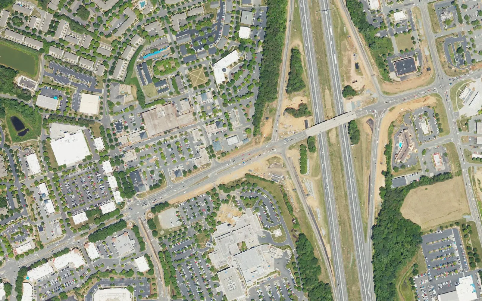
Eleven Huntersville areas compared: ZIP code, zoned high school and typical home value. The town splits among Hopewell, Hough and North Meck high schools.
Last checked Oct. 11, 2026. Sources: the Town of Huntersville’s 2040 Community Plan (PDF) and plans and studies page, with the small area plans linked from it, OpenStreetMap place names, Charlotte-Mecklenburg Schools’ 2026-27 feeder boundaries as published by Mecklenburg County, the county’s town limits and ZIP code map data, the N.C. Department of Public Instruction’s 2025-26 accountability data, the U.S. Census Bureau’s QuickFacts and Zillow Research.
Huntersville is a town of 63,969 people, by the Census Bureau’s 2020-2024 American Community Survey estimates, with about 42 square miles inside its limits on Mecklenburg County’s map. Interstate 77 runs north and south through the middle, with exits at Gilead Road (Exit 23) and N.C. 73, Sam Furr Road (Exit 25), and I-485 crosses the south end. Downtown sits a mile east of Exit 23 on Old Statesville Road (N.C. 115). West of the interstate the town reaches the Catawba River and Mountain Island Lake; to the east, its limits break into separate pieces toward the Cabarrus County line. Three facts shape where you live here more than any neighborhood name:
- One ZIP code, one market figure. Nearly every address in town is in 28078, so Zillow’s ZIP figure, $537,945 in August 2026, is the same for every area below. Zillow’s figure for the town as a whole was $546,644. The ZIP code also reaches beyond the town line.
- School zones do not follow neighborhood names or the I-77 line. Every address in town is in Charlotte-Mecklenburg Schools, but the feeder zones send about half the parcels in town to Hopewell High, a quarter to William Amos Hough High in Cornelius and a quarter to North Mecklenburg High. Downtown itself is split between Hough and North Meck at the railroad.
- Town or county. Many homes with Huntersville addresses are outside town limits, in unincorporated Mecklenburg County or the town’s extraterritorial jurisdiction. That changes the tax bill and some services. A sliver of the town is in Cabarrus County, the state’s tax rate table shows.
What this means for you
- Look up any address on Mecklenburg County’s GeoPortal school lookup or call CMS Student Placement, 980-343-5335.
- Check whether a parcel is in town, and its assessed value, on the county’s property record search.
- Zillow’s figures are a modeled typical value for the middle third of homes, not a sale price.
The areas at a glance
High school is the one zoned for most parcels in the area in the 2026-27 CMS feeder data; home value is the Zillow Home Value Index for the area’s ZIP code in August 2026.
| Area | ZIP code | Zoned high school | Typical home value | Guide |
|---|---|---|---|---|
| Downtown | 28078 | Hough west of the railroad, North Meck east | $537,945 | Downtown |
| Pottstown | 28078 | North Meck | $537,945 | Pottstown |
| Sam Furr Road | 28078; some 28031 | Hough | $537,945 / $538,569 | Sam Furr Road |
| Ramah Church Road and N.C. 73 East | 28078 | Hough; North Meck in the east | $537,945 | Ramah Church Road |
| Clarke Creek | 28078 | North Meck | $537,945 | Clarke Creek |
| Eastfield Road | 28078 | North Meck | $537,945 | Eastfield Road |
| Hambright Road and Bryton | 28078 | North Meck | $537,945 | Hambright Road |
| Birkdale | 28078 | Hopewell; Hough around Birkdale Village | $537,945 | Birkdale |
| Rosedale | 28078 | Hopewell | $537,945 | Rosedale |
| Hicks Crossroads | 28078 | Hopewell | $537,945 | Hicks Crossroads |
| Long Creek | 28078 | Hopewell | $537,945 | Long Creek |
In 2025-26, 60.8% of state tests at Hopewell High were at grade level or above, 82.9% at William Amos Hough High and 54.6% at North Mecklenburg High, the state’s accountability data shows. The CMS figure was 60.9%. Zillow’s typical value for ZIP code 28078 was up 0.4% from August 2025. More in our schools guide and home prices guide.
Map
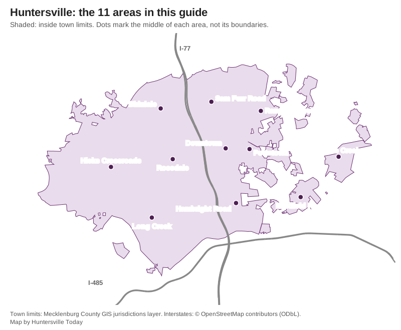
Town limits from Mecklenburg County’s jurisdictions map data; interstates © OpenStreetMap contributors. The dots mark the middle of each area, not its boundaries.
East of I-77: downtown and the old town
Downtown. The Gilead Road and Old Statesville Road crossroads, the subject of the town’s 2023 Downtown Master Plan, with Veterans Park and the downtown greenway.
Pottstown. The historic neighborhood east of Church Street between Ramah Church and Holbrooks roads, covered by the town’s East Huntersville plan, with David B. Waymer Park.
Hambright Road and Bryton. South Huntersville’s school campuses on Hambright Road, North Mecklenburg High and the Bryton shopping district.
The north and east
Sam Furr Road. The land between I-77 Exit 25 and N.C. 115, all zoned for Hough High, with North Mecklenburg Park.
Ramah Church Road and N.C. 73 East. Northeast Huntersville toward Davidson-Concord Road, with R.C. Bradford Park.
Clarke Creek. East Huntersville south of Huntersville-Concord Road near the Cabarrus line, the subject of a 2018 town plan.
Eastfield Road. The southeast pieces of town around Asbury Chapel Road, with the planned Huntersville Village center near Prosperity Church Road.
West of I-77
Birkdale. Birkdale Village and Northcross on Sam Furr Road, with the Northcross Park & Ride.
Rosedale. Gilead Road west of Exit 23, the Rose Commons shops and the Torrence Creek greenways.
Hicks Crossroads. Beatties Ford Road from N.C. 73 to Hambright Road, with Rural Hill and Buckeye Cove nature preserves.
Long Creek. Southwest Huntersville around Hopewell High and Long Creek Elementary, next to Latta Nature Preserve.
How we built this
- Which areas. We used only places a source names and that we could put on a map. The town’s 2040 Community Plan names Downtown, Pottstown, Birkdale Village, Northcross, Rosedale, Bryton, the Beatties Ford Road and N.C. 73 mixed-use center, and the Huntersville East, Huntersville Village, Long Creek Village and Hopewell Village activity centers. The town’s small area plans set the boundaries we used for Downtown (Downtown Master Plan, 2023), Pottstown (East Huntersville Area Development Plan, 2007), Sam Furr Road (N.C. 73 and U.S. 21 plan, 2005), Rosedale (Gilead Road and U.S. 21 plan, 2005), Hicks Crossroads and Long Creek (Beatties Ford Road Corridor plan, 2007, and the Beatties Ford Road and Mt. Holly-Huntersville Road plan, 2005), Eastfield Road (2014) and Clarke Creek (2018). OpenStreetMap place nodes name Downtown, Rosedale, Birkdale, Hicks Crossroads, Caldwell and Cowan’s Ford.
- Left out. Vermillion and Skybrook are named in the town’s plans but are single subdivisions, so they have no page of their own; Skybrook is mentioned on the Clarke Creek page. Most other OpenStreetMap names in and around the town are subdivisions or places in Charlotte, Cornelius or Davidson. We found no homeowners association registry on the town’s site, so no page lists HOAs.
- Schools. We placed all 28,184 tax parcels inside town limits on the CMS 2026-27 feeder boundaries that Mecklenburg County publishes and report the shares that came back. Zones change; check your own address.
- Distances are measured on OpenStreetMap roads with the OSRM routing engine. They are distances, not drive times.
Comparing towns instead? See Huntersville vs Cornelius vs Davidson vs Mount Holly, our moving to Huntersville guide and our property tax guide.
Frequently asked questions
What are the neighborhoods in Huntersville, N.C.?
This guide covers 11 areas named in the town’s plans or on OpenStreetMap: Downtown, Pottstown, Birkdale, the Sam Furr Road area, Ramah Church Road and N.C. 73 East, Clarke Creek, Eastfield Road, Hambright Road and Bryton, Rosedale, Hicks Crossroads and Long Creek.
Which high school is my Huntersville address zoned for?
It depends on the address. In Charlotte-Mecklenburg Schools’ 2026-27 feeder data, about half the parcels in town are zoned for Hopewell High, a quarter for William Amos Hough High in Cornelius and a quarter for North Mecklenburg High. Look up your address on Mecklenburg County’s GeoPortal or call CMS Student Placement at 980-343-5335.
What ZIP code is Huntersville?
Almost all of the town is in ZIP code 28078. A few parcels at the north end near Cornelius carry 28031. Zillow’s typical home value in August 2026 was $537,945 in 28078 and $546,644 for the town as a whole.
Is every Huntersville mailing address inside the town?
No. Town limits are irregular, especially east and southwest of downtown, and many homes with Huntersville addresses are in unincorporated Mecklenburg County or the town’s extraterritorial jurisdiction. That changes the tax bill and some services.
What is the population of Huntersville?
63,969, according to the Census Bureau’s 2020-2024 American Community Survey five-year estimates.
Have your say