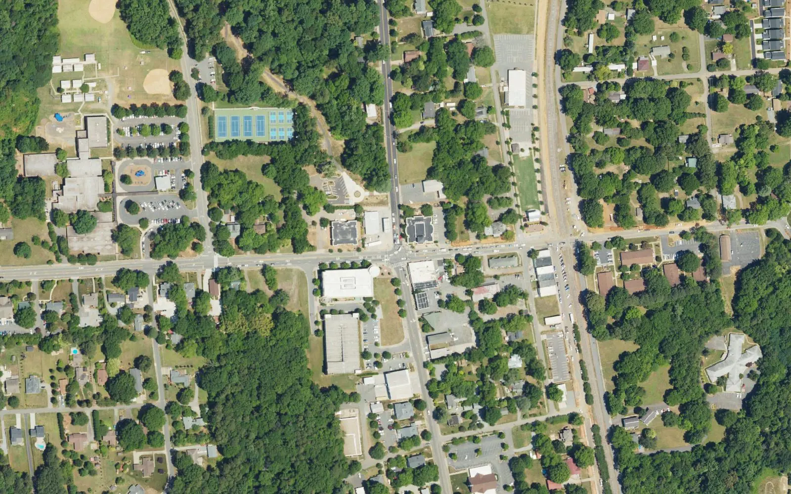
Downtown Huntersville is the crossroads of Gilead Road and Old Statesville Road (N.C. 115), in ZIP code 28078, split between Hough and North Meck High.
Last checked Oct. 11, 2026. Sources: the Town of Huntersville’s Downtown Master Plan page and 2040 Community Plan (PDF), OpenStreetMap place names and store listings, Charlotte-Mecklenburg Schools’ 2026-27 feeder boundaries as published by Mecklenburg County, the N.C. Department of Public Instruction’s 2025-26 accountability data, Mecklenburg County’s park and bus stop data and Zillow Research.
Downtown Huntersville grew up where Gilead Road meets Old Statesville Road (N.C. 115), with Main Street and the railroad just to the east. East of N.C. 115, Gilead Road becomes Huntersville-Concord Road. The town’s Downtown Master Plan, adopted April 17, 2023, lays out a 10- to 20-year vision for this core, and the town’s 2040 Community Plan treats downtown as a mixed-use center with its own rules for streetscape and building size. Every address here is in ZIP code 28078.
What this means for you
- Zoned high school: William Amos Hough High in Cornelius for most addresses west of the railroad, 82.9% of state tests at grade level in 2025-26; North Mecklenburg High east of it, 54.6%. Check yours on the county’s GeoPortal school lookup.
- Home value: $537,945 in ZIP code 28078 in August 2026, according to the Zillow Home Value Index.
- Nearest I-77 exit: Exit 23, Gilead Road, about 0.9 mile by road.
Part of our Huntersville neighborhoods guide.
Where it is
The Downtown Master Plan focused on the quarter-mile around the intersection of Gilead Road and Old Statesville Road, about a five-minute walk, and split it into four quadrants divided by Main Street and by Gilead Road and Huntersville-Concord Road. This guide uses a slightly wider area: the town east of I-77, from Holbrooks Road north to Stumptown Road and Ramah Church Road, and west of the streets just east of the railroad. Pottstown is to the east, Rosedale across I-77 to the west and the Sam Furr Road area to the north. We counted 1,458 tax parcels inside town limits in this area.
The Huntersville Arts and Cultural Center at 109 S. Old Statesville Road and Veterans Park are downtown, according to the county’s park data.
Schools
Downtown is in Charlotte-Mecklenburg Schools. We placed every downtown parcel on the district’s 2026-27 feeder boundaries, which Mecklenburg County publishes, and the zone line runs roughly along the railroad:
- West of the tracks (74% of parcels): Huntersville Elementary, Bailey Middle and William Amos Hough High.
- East of the tracks (26%): Blythe Elementary, J.M. Alexander Middle and North Mecklenburg High.
Scores are the share of state tests at grade level or above in 2025-26 and the state’s growth rating, from the accountability data.
| Level | School | At grade level | Growth |
|---|---|---|---|
| Elementary | Huntersville Elementary, 200 Gilead Road | 80.4% | Exceeded |
| Elementary | Blythe Elementary, 12202 Hambright Road | 68.2% | Exceeded |
| Middle | Bailey Middle, 11900 Bailey Road, Cornelius | 79.6% | Met |
| Middle | J.M. Alexander Middle, 12010 Hambright Road | 40.7% | Not met |
| High | William Amos Hough High, 12420 Bailey Road, Cornelius | 82.9% | Exceeded |
| High | North Mecklenburg High, 11201 Old Statesville Road | 54.6% | Exceeded |
The CMS figure for all its schools was 60.9%. Zones change; check your own address on the GeoPortal or call CMS Student Placement at 980-343-5335. More in our schools guide.
Home values
Zillow publishes no figure for downtown. The Zillow Home Value Index is a modeled typical value for the middle third of homes, not a sale price.
| Area | August 2026 | August 2025 | Change |
|---|---|---|---|
| ZIP code 28078 | $537,945 | $535,683 | +0.4% |
| Town of Huntersville, for comparison | $546,644 | $544,057 | +0.5% |
ZIP code 28078 covers almost all of Huntersville, so the figure is not downtown’s alone. Trends are on our home prices page.
Parks and trails
From Mecklenburg County’s park data:
- Veterans Park, 201 Huntersville-Concord Road: the downtown event park, home of the Growers’ Market and holiday events.
- Holbrook Park, 100 Sherwood Drive: tennis, pickleball, a playground and a walking trail.
- Abernathy Park, 205 Glendale Drive, and Greenway Park, 226 Greenway St.
- The Huntersville Downtown Greenway, about 1.1 miles, with a trailhead at 102 Gilead Road. The Torrence Creek Tributary Greenway touches the area’s west edge.
More in our parks and trails guide.
Getting around
- I-77: Exit 23 at Gilead Road is about 0.9 mile by road; Exit 25 at N.C. 73 (Sam Furr Road) about 4.3 miles.
- Charlotte Douglas International Airport: about 20.6 miles by road.
- Buses: county stop data lists the Huntersville Gateway Park & Ride, served by CATS routes 177 and 63X, and Route 48X stops on Statesville Road. Schedules are on ridetransit.org.
Distances were measured with the OSRM routing engine on OpenStreetMap roads from a point near the middle of the area. They are distances, not drive times. Parking for downtown events and more are in our getting around guide.
Groceries and everyday stores
OpenStreetMap lists a Food Lion at 706 Gilead Road and an ALDI at 14126 Statesville Road on the west side of the area. The larger grocery and pharmacy cluster at Rosedale is across I-77; see the Rosedale guide.
Frequently asked questions
Where is downtown Huntersville?
Around the crossroads of Gilead Road and Old Statesville Road (N.C. 115), about a mile east of I-77 Exit 23. The town’s 2023 Downtown Master Plan centers on that intersection and on Main Street, which runs beside the railroad.
What schools serve downtown Huntersville?
It depends on the side of the railroad. In Charlotte-Mecklenburg Schools’ 2026-27 feeder data, 74% of downtown parcels, mostly west of the tracks, are zoned for Huntersville Elementary, Bailey Middle and William Amos Hough High; the rest are zoned for Blythe Elementary, J.M. Alexander Middle and North Mecklenburg High.
What is the typical home value in downtown Huntersville?
Downtown is in ZIP code 28078, where the Zillow Home Value Index was $537,945 in August 2026, up 0.4% from August 2025. Zillow publishes no figure for downtown alone.
Where can I park in downtown Huntersville?
The town lists the Town Center parking garage at 105 Gilead Road, the Huntersville Elementary lot at 200 Gilead Road and the downtown greenway trailhead at 102 Gilead Road for downtown events.
Have your say