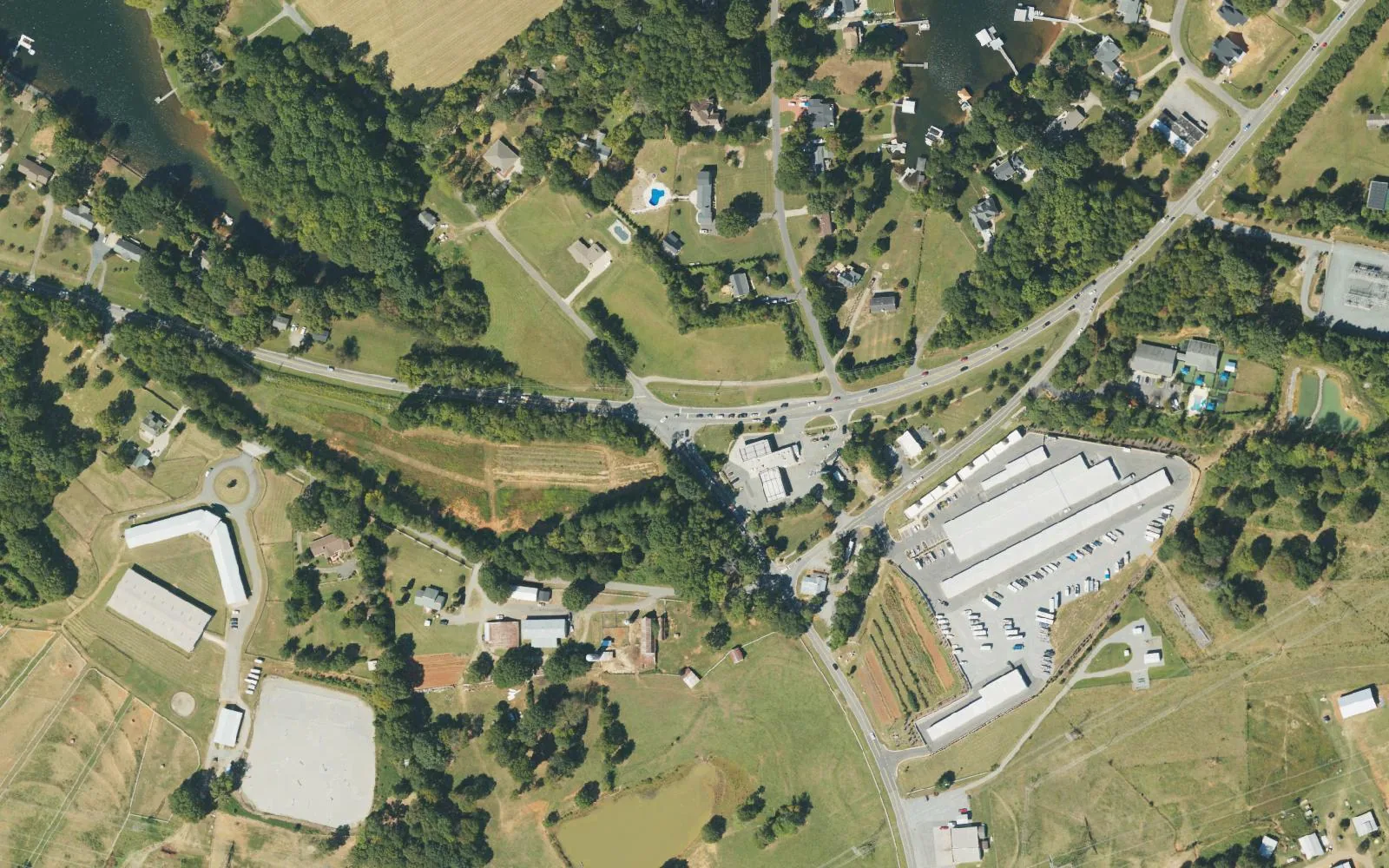
West Huntersville along Beatties Ford Road from N.C. 73 to Hambright Road, in ZIP code 28078, zoned for Barnette, Bradley Middle and Hopewell High.
Last checked Oct. 11, 2026. Sources: the Town of Huntersville’s Beatties Ford Road Corridor Small Area Plan (PDF), Beatties Ford Road Protection / Enhancement Strategy Plan page and 2040 Community Plan (PDF), OpenStreetMap place names and store listings, Charlotte-Mecklenburg Schools’ 2026-27 feeder boundaries as published by Mecklenburg County, the N.C. Department of Public Instruction’s 2025-26 accountability data, Mecklenburg County’s park, greenway and bus stop data and Zillow Research.
Hicks Crossroads is the name OpenStreetMap gives to the meeting of N.C. 73 and Beatties Ford Road in western Huntersville. South of it, Beatties Ford Road runs through the rural west side of town toward Hambright Road, with the Catawba River and Mountain Island Lake beyond. The town’s Beatties Ford Road Corridor Small Area Plan, adopted in September 2007, describes the corridor’s “pastoral, agrarian landscapes” and set out to balance that rural character with growth. Homes here are in ZIP code 28078.
What this means for you
- Zoned high school: Hopewell High for every parcel inside town limits, 60.8% of state tests at grade level in 2025-26. Check yours on the county’s GeoPortal school lookup.
- Home value: $537,945 in ZIP code 28078 in August 2026, according to the Zillow Home Value Index.
- Nearest I-77 exit: Exit 23, Gilead Road, about 4.3 miles by road.
Part of our Huntersville neighborhoods guide.
Where it is
The 2007 plan’s 14,000-acre study area runs from N.C. 73 south to Mt. Holly-Huntersville Road, between the town’s western edge on the river and lake and a line along Oliver Hager, Ervin Cook and Gilead roads. The plan splits it into three districts. This guide covers the first two: North, from N.C. 73 to Bud Henderson Road, and Central, from Bud Henderson Road to Hambright Road. The South district is in our Long Creek guide.
The plan noted that commercial uses were limited to a few small businesses in the north. The town’s 2040 Community Plan now plans a mixed-use center at N.C. 73 and Beatties Ford Road, where it counts about 23 vacant acres zoned for commercial and residential use and 20 acres already in commercial use. Much of the land west of Beatties Ford Road is in the plan’s rural conservation and critical watershed areas, which limit how densely it can be built because it drains to Mountain Island Lake, a drinking water source. A separate town strategy plan for Beatties Ford Road, listed as under review, weighs traffic safety against the road’s historic and scenic character.
The 2007 plan also notes the area’s history: Cowan’s Ford, in the northwest corner, was the site of the Battle of Cowan’s Ford on Feb. 1, 1781, where Gen. William Lee Davidson was killed. Birkdale and Rosedale are to the east. We counted 5,380 tax parcels inside town limits in this area.
Schools
The area is in Charlotte-Mecklenburg Schools. On the district’s 2026-27 feeder boundaries, which Mecklenburg County publishes, every parcel in this area is zoned for the same three schools:
| Level | School | At grade level | Growth |
|---|---|---|---|
| Elementary | Barnette Elementary, 13659 Beatties Ford Road | 69.0% | Exceeded |
| Middle | Francis Bradley Middle, 13345 Beatties Ford Road | 60.9% | Not met |
| High | Hopewell High, 11530 Beatties Ford Road | 60.8% | Exceeded |
Scores are the share of state tests at grade level or above in 2025-26 and the state’s growth rating, from the accountability data. Hopewell graduated 89.6% of its students in four years. The CMS figure for all its schools was 60.9%. Zones change; check your own address on the GeoPortal or call CMS Student Placement at 980-343-5335. More in our schools guide.
Home values
Zillow publishes no figure for this area. The Zillow Home Value Index is a modeled typical value for the middle third of homes, not a sale price.
| Area | August 2026 | August 2025 | Change |
|---|---|---|---|
| ZIP code 28078 | $537,945 | $535,683 | +0.4% |
| Town of Huntersville, for comparison | $546,644 | $544,057 | +0.5% |
ZIP code 28078 covers almost all of Huntersville, so the figure is not this area’s alone. Trends are on our home prices page.
Parks and trails
From Mecklenburg County’s park data:
- Rural Hill Nature Preserve, 4431 Neck Road: walking trails and a historic farm site.
- Buckeye Cove Nature Preserve, with entrances at 5901 Stephens Road and 4918 Cashion Road: walking trails.
- Richard Barry Memorial Park, 13707 Beatties Ford Road: a playground, a shelter and a walking trail.
- Edgewater Farm Park, 14810 Brown Mill Road, a county site listed as undeveloped.
- Cowans Ford Wildlife Refuge, 2329 Neck Road, a county refuge just outside the town line.
The natural-surface McDowell Creek Dirtway crosses the east side, according to the county’s greenway data. More in our parks and trails guide.
Getting around
- I-77: Exit 23 at Gilead Road is about 4.3 miles by road from a point near the middle of the area’s homes; Exit 25 at N.C. 73 about 5.8 miles.
- Downtown Huntersville: about 4.6 miles by road.
- Charlotte Douglas International Airport: about 22.4 miles by road.
- Beatties Ford Road is the only continuous north-south route in western Huntersville between N.C. 73 and central Charlotte, the town says.
- Buses: county stop data lists no CATS stops in this area. The nearest is the Northcross Park & Ride (routes 177 and 48X); see ridetransit.org.
Distances were measured with the OSRM routing engine on OpenStreetMap roads. They are distances, not drive times. More in our getting around guide.
Groceries and everyday stores
OpenStreetMap lists no supermarket or pharmacy in this area. The nearest are in Birkdale: a Harris Teeter at 7715 Regency Park Drive and a Whole Foods Market at 9129 Sam Furr Road.
Frequently asked questions
Where is Hicks Crossroads in Huntersville?
At the intersection of N.C. 73 and Beatties Ford Road in western Huntersville. OpenStreetMap marks Hicks Crossroads there, and the town’s 2040 plan plans a mixed-use center around the intersection.
What schools serve the Beatties Ford Road area of Huntersville?
Every parcel inside town limits in this area is zoned for Barnette Elementary, Francis Bradley Middle and Hopewell High in Charlotte-Mecklenburg Schools’ 2026-27 feeder data. Barnette and Bradley are on Beatties Ford Road in the area, and Hopewell is just south at 11530 Beatties Ford Road.
What parks are near Hicks Crossroads?
Rural Hill Nature Preserve at 4431 Neck Road, Buckeye Cove Nature Preserve on Stephens and Cashion roads and Richard Barry Memorial Park at 13707 Beatties Ford Road, from Mecklenburg County’s park data.
What is the typical home value along Beatties Ford Road in Huntersville?
The area is in ZIP code 28078, where the Zillow Home Value Index was $537,945 in August 2026, up 0.4% from August 2025. Zillow publishes no figure for the area alone.
Have your say